Top 5 best navigators for android. Choosing the best navigator for Android
GPS navigation is one of the most requested features on a smartphone. When exploring the city by car or bicycle, it is essential to follow the optimal path. Navigators will help you optimize auto and pedestrian routes, get to the right coordinates faster.
We compared popular, top mobile navigators. The main criteria: ease of use, functionality and price (free) of the navigator. At the end of the review, let's summarize: which navigator is the best.
Members:
Over time, the review will be updated with new gps programs. If, in your opinion, there are more interesting navigators for Android, leave your comments at the end of the article, through the contact form. Thank you!
Google Maps for Android - standard android navigator
Considering Google Maps a year ago, we noted: some functions of the navigator are not finalized, not optimized. By 2019, the situation has improved markedly – especially in terms of user experience. However, we note some of the roughness of Google Maps.
The offline maps download feature is relatively recent. It allows you to plot routes and navigate the map without an Internet connection. Due to the fact that offline maps are not yet a fully tested function, not everything is so smooth with it. However, like other Android-navigators.
The inconvenience is that you can not download maps for large regions of Ukraine, Russia, Belarus and other CIS countries. Only separate offline maps of large cities or regions are available. When leaving the city limits, it is difficult for a motorist to do without online synchronization.
Disadvantages of Google Maps
1) The choice of locations and attractions in Google Maps is rather poor: to get complete information about available nearby hotels, restaurants, shops, schools, etc., you have to use third-party applets (Foursquare, TripAdvisor, Yandex.City).
2) No data on accidents; you cannot add points with car accidents yourself, which would be quite useful for alerting other drivers.
3) In comparison with Yandex Navigator, there is no warning about speed control, there are no alternative voice assistants.
Advantages of Google Maps
However, Google Maps also has many positive aspects.
Yandex Navigator: navigator with voice control
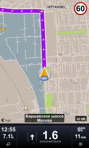
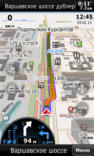
U interface mobile version Yandex Navigator is well structured and visual. When moving by car along the route, it displays information about the approximate remaining time to the destination and the distance to the end point. If along the way you need to stop at a service station, gas station or car wash, you can specify an additional point on the Yandex Navigator map - and the route will be optimally recalculated taking into account waypoint. You can toggle the traffic and directions layer on and off by pressing a single yellow traffic light button.
The exclusive features of the navigator include a night gps mode for Android, where the map is displayed in dark colors, without distracting the driver's attention while driving at a late time and does not make the eyes very tired when considering objects. By the way, the set of POIs available for searching is really impressive. Along with the already familiar restaurants, ATMs and cinemas, you can use layers to display nearby points of contact, post offices, salons and many other interesting places.
Another nice feature is voice control from your phone. Similar to Google Maps, you can search for the necessary objects on the map, request addresses on the map.
As for the offline operation of the program, you can download gps-maps for Android for large settlements in Ukraine, Russia and Belarus. By turning on Yandex Navigator offline, you can view them, however, you can get directions, search for local attractions on the map only if you have a network connection.
Thus, Yandex Navigator for Android leaves the most pleasant impression of itself. The product claims to be the best free gps navigator and for Android in 2019.
Navitel: a well-designed gps-navigator for Android
Navitel Navigator is a gps-program from a leading developer in the field of navigation and digital map creation. To purchase the cards themselves, you will have to fork out a small amount, but if you wish, you can also download them for free on torrents or file sharing services (for example, on the pda forum).
Strengths of Navitel Navigator
1) Map display options: switching between 2D and 3D modes, which in some situations will be especially useful.
2) Convenient interface. The lion's share of branded chips is available in the top line for quick access. Choice between night and day skin
4) Switching between satellites: under any weather conditions, a map with POI is always available.
Note. Not so long ago we made for Android, where we listed in detail all the advantages and individual “features”.
Navitel Navigator: GPS routes on the screen
5) Convenient control. When navigating a route, managing the map is quite intuitive and simple: there is a zoom function, map rotation according to movement, the ability to switch between preset profiles for any type of transport.
6) Informativeness. The movement is visually accompanied by information about the speed of the object, the remaining time to reach the destination, the distance of the next turn and audio support. In general, navigation is well thought out and intuitive.
Good thoughtfulness of the functional part and high-quality design turn mobile app Navitel as the main candidate in the nomination "Best gps navigator for Android".
Waze - informative GPS-navigator for Android
Waze (Free) is a free navigator for Android with open source code.
Benefits of Waze
1) Social features integrated into Waze greatly improve driving experience. Waze users report problems on the road – be it repairs, accidents, traffic jams, traffic police posts, cameras and other “troubles”. Accordingly, other drivers are already aware of the changes. In addition to reviews, the application collects information from its own database on the server.
2) Map with routes - informative. Waze uses proven OSM cards. They are highly detailed and accurate.
3) Waze automatically re-routes if the phone crashes, app crashes, or anything else that might interrupt navigation. Standard Google Maps does not. Likewise, Waze makes it easy to see your route or map when you need it and always return to driving mode.
OsmAnd: offline navigation for Android
Let's list strengths Navigator OsmAnd.
Advantages of OsmAnd
1) Autonomy. OsmAnd is, first of all, a good offline navigator. Suitable for those who prefer to download maps to their gadget once and no longer connect to the Web while offline.
2) Maps. For navigation in OsmAnd, raster and vector maps of Open Street Maps, compiled by users of the service, are used. They allow you to filter POI objects (points of interest, museums, theaters, pharmacies, etc.), select a profile for the corresponding vehicle. The route of movement can be optimized taking into account the shortest distance, avoiding toll roads, dirt roads, ferries, motorways.
OsmAnd is one of the best navigators for Android
3) Customizable maps. You can add objects yourself, create or edit maps. Thanks to the support of plugins, the OsmAnd functionality is greatly expanded: for example, you can activate the OsMo live monitoring system with tracking other gadgets using the service; be added to groups; download sea and ski maps; calculate the optimal distances between the specified points using GPX; impose contour lines and relief layers, which will surely be appreciated by tourists and athletes).
4) Additional features. All the standard features for GPS navigators are also present: voice control, assistant, screen reorientation, profile switching.
Maps.me
Maps.me is a GPS navigator popular in Russia, USA and Germany. It is characterized by high accuracy and autonomy of maps.
Strengths of Maps.me
1) The accuracy and detail of maps is almost the most important thing, regardless of the type of transport. This navigator will be of interest to travelers and pedestrians, since the map displays the smallest details - trails, benches, names of objects.
2) Additional layers. Maps.me displays vector maps, through layers you can also display traffic jams and .
3) Lots of settings. In the maps.me settings, you can change the units of measurement, zoom, view the history of movement, and more. There are navigation settings, in particular, you can set up auto zoom, voice instructions, enable the display of speed cameras.
4) Switching navigation modes. The choice is car, pedestrian, public transport, taxi and bicycle.
5) Autonomy. Offline maps downloaded to a mobile device take up little space, while they work fully, as if the Internet was present. It is clear that realtime functions will not be available, but for a pedestrian or a cyclist, information about traffic jams is not as important as for motorists.
Disadvantages of Maps.me
1) Limited navigation for motorists. It is difficult to call Maps.me a perfect auto-navigator. At a minimum, travel routes are not always lined up correctly, not to mention the fact that the navigator does not offer alternative options.
2) There are errors. Since the maps are developed by the community, the data is not always relevant, especially for remote places and villages.
3) A rather inconvenient map display mode. Maps look very dry, scaling may not work.
Which of the navigators is the best as of 2019
Each of the android navigators, in some aspects (functions, maps) is better than its competitors and is good in its own way. Which navigator is right for you depends on your preferences and beliefs. We hope that we helped you choose the right application and it will remain on your phone.
| Navigator app | Developer | Price | Offline map support | Traffic jams | voice acting | Russian language |
| Google Maps | Google Inc. | for free | + | + | + | + |
| Yandex Navigator | Yandex | for free | + | + | + | + |
| Navitel Navigator | Navitel | from 1000 rub. | + | + | + | + |
| Waze | Waze Navigation | for free | + | + | + | + |
| OsmAnd for Android | OsmAnd | from 6.75 $ | + | + | + | + |
Yandex Navigator absolutely free and has great functionality. He wins in the nomination "The best navigator for Android with Yandex Maps support".
Navitel Navigator created and supported by the most famous company, so the quality of products and technical support are on top - both for Android OS and others mobile devices.
Navigation application Waze- certainly attracts with its openness and free cards. However, like any developing product, this navigator is not perfect. We hope that the growing community will positively affect the quality of the application. For 2019, alas, Waze maps are inferior in terms of information content to the same Navitel or Google Maps.
Concerning OsmAnd, then this offline navigator for Android will perfectly serve in conditions of impossibility to connect mobile device to the network and works using open technologies.
Google Maps- Navigator with voice control function. The good thing is that it is available out of the box (that is, it is initially present as part of Android). Google Maps is suitable for inexperienced travelers and drivers, it can be called one of the best offline navigators.
Maps.me will appeal to avid travelers and walkers. The navigator will delight you with detailed maps adapted for walking. For motorists, we would recommend alternatives - Google Maps or Yandex Navigator.
GPS navigation on a smartphone for modern man is one of the most requested features. After all, it is so important to be mobile and have up-to-date access to data about your location. Not only studying a foreign city, but also, if necessary, finding some street in your own, traveling or following a route for work purposes, it is important to get to the required place as quickly as possible.
But how to find the best navigator for Android? After all, there are a huge number of such navigators. And there is simply no time to test everyone. That is why we have carefully analyzed this software and, especially for you, have compiled the top navigators for Android 2018-2019, which will help to significantly optimize traffic on pedestrian and car routes.
#10 - MapFactor
This program is free and can be used to work on Android phones and tablets. Since the maps are installed directly in the gadget's memory (as an option - on an SD card), it is quite possible to use it without an Internet connection, which is very convenient. Maps are updated periodically. Typically, this happens once a month.
The functionality of the application allows you to plan your route in advance, choosing the most best option from a list of choices. Remarkably, if you exceed the speed limit, a characteristic sound warning appears. In addition, this free program fully satisfies the demand for full-fledged satellite navigation.

Important features of this program are:
- Drawing up a route plan;
- Intuitive navigation in various languages;
- Color schemes (day and night);
- You can add your routes and places;
- Rotate the map in the direction of your movement;
- Permanent updates and periodic map improvements;
- Work in 2D and 3D display format.
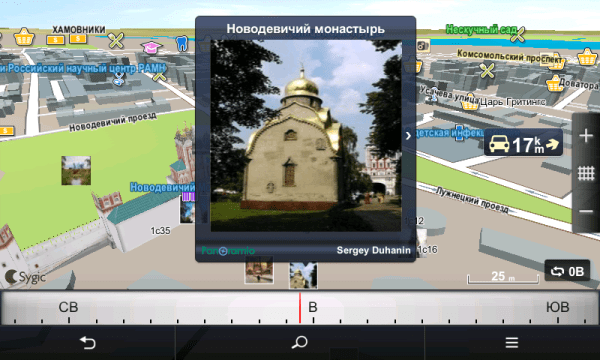
#9 - SYGIC
A worthy place in the category of the best navigators for android is in the SYGIC program. This is a modern application that integrates 3D offline maps from TomTom. The functionality allows you to navigate even in a completely unfamiliar place. Since the developer is trying to be among the leaders, the innovative ability to give commands by voice is provided. The main purpose of such an application is to help motorists. Using the functionality of the program, it is easy to control the situation on the road, to form your route almost instantly, without wasting time on traffic jams.

- Ability to work offline without an active connection to the World Wide Web;
- Projection (navigation recommendations can be projected onto the windshield of a car, this is the highlight of the program);
- Search for the most successful route among the many offered to choose from;
- Driver warnings about speed limits, sharp turns, cameras that monitor traffic;
- Maps are constantly updated;
- Built-in information about points of interest.
No. 8 - OsmAnd
The program will be a good helper for tourists, drivers, those who are in a foreign city on a business trip. It is implemented in two versions - paid and free. Unfortunately the functionality free version cut off substantially. For example, it is limited in loading maps and does not provide support for local Wikipedia. Paid version can also be used when there is no active Internet connection. Access to the network is only necessary to download the program, maps, and then you can use the navigator offline.
 The features of the program are:
- Availability of free and paid version;
- Switching to night and day mode;
- Ability to use without an Internet connection;
- The presence of useful functions - changing the size of the text, the option "show horizontal lines", "rendering style" and so on.
No. 7 - Navigator Seven Roads
If you need high-quality navigation in Russia, this option is quite suitable. What are its advantages and features? IN Play market about 15 thousand users rated this navigator at 4.2 points, which is quite good. The program itself is easy to use, its interface is very comfortable and intuitive.

The main features of the application are:
- Ability to use maps offline: download once and use;
- You can search for an object by name, not just by address;
- Choosing the most convenient and shortest route;
- Voice prompts;
- Saving routes;
- Customizing the program to suit your needs.
No. 6 - OsmAnd offline navigator for Android
A very worthy option for high-quality navigation, which captivates simple interface and a whole package of convenient options.

Among the features of the program, the following deserve attention:
- Ability to use without a connection to the World Wide Web.
- Smart routing functionality.
- In case of deviation from the previously set route, it is possible to recalculate it.
- Determining the time left before arriving at the destination.
- The ability to track movement on the map and zoom objects.
- Voice prompts.
#5 - Navitel GPS & Maps
The program attracts with the presence of very accurate navigation even offline, detailed high-quality maps of 64 countries of the world and other useful functionality.

Key Features this application:
- Ability to work on almost all phone models, even on the weakest;
- Accuracy, speed and a whole set of the most accurate and fresh maps for many cities in the world;
- Work in the absence of an active Internet connection;
- Convenient navigation;
- Informative cards.
No. 4 - Waze
Free software for fast and easy navigation. The program is available not only on the Android platform, but also on almost all other platforms. operating systems which makes it especially comfortable.

The features of this application are:
- The ability to track the situation on the roads online;
- Paving the most optimal and shortest routes;
- Providing information on the location of radars.
№3 - 2GIS
A high-quality modern program for comfortable navigation, which has a pleasant and quite convenient interface for daily use.

The main features of this application are the following:
- Selection of the most successful route option, taking into account the current traffic situation;
- You can calculate the time it will take to reach the final goal;
- Displays information about the distance between objects;
- Opportunity automatic change the route, taking into account the divorced bridges, traffic jams, blocked streets, etc.;
- Warning about speeding and the presence of traffic police cameras;
- Building a route bypassing toll roads;
- Availability of night mode;
- The ability to work offline, but in this case you will not be able to use the route building option, given the current traffic congestion.
#2 - Google Maps Navigation
This application is an indispensable assistant on the road. It has really powerful functionality that will delight you with its comfort and ease of use. Using such a program, you will spend a minimum of time on the road, even during the busiest time. You can easily find a cafe, restaurant or gas station along the way, navigate in a completely unfamiliar city.

The important features of this application are the following:
- Support GPR navigation;
- Information about traffic jams, public transport;
- Automatic restructuring of the route, taking into account the current situation on the road;
- In addition, such an application will tell you in advance which lane is better to choose for the exit or turn;
- Use offline, without an active Internet connection;
- You can lay out your route for movement by car, on foot or by public transport;
- The application database includes data and maps of 220 countries, descriptions of over 100 million places.
No. 1 - Yandex Navigator

The main features of this program are:
- The ability to plot a route taking into account traffic jams;
- Voice prompts, including in the background;
- Reflection of road events and even schemes of houses;
- Demonstration of the current speed, distance to the target and the expected time required for the route;
- Option to search for nearby objects of interest, such as restaurants, cinemas, gas stations;
- Work online and offline;
- Constant real-time traffic updates;
- Travel history;
- Reflection of data on allowed free and paid parking places;
- Hints that a parking space has become free;
- Adding your own comments to places or routes;
- Marks on the maps - information about traffic accidents and road repairs;
- Satellite view.
For the modern user, there are many high-quality navigators to choose from. The functionality of each program is different, but each of them is able to satisfy basic requests when moving in a large city or an unfamiliar place. Which navigator is better to install on Android - the decision is up to you.
If you are reading this, it means that you were interested, so please subscribe to our channel on, well, for one, put a like (thumbs up) for your work. Thank you!
Here is the final part of the "series" about the popular car navigation applications for Android. In it, we tried to summarize all the information from five previously published reviews. individual applications and give a final assessment. In order not to burden the reader, we will try to make it as concise and illustrative as possible using tables, providing them with relatively small comments.
What is the reason for choosing these particular applications? The main criteria were popularity and the presence of a large number of positive feedback as well as ease of use. The updated Shturmann did not fit into the first two criteria a little. According to all three criteria, the application "Seven Roads" did not pass. Google Maps as a navigator is still in beta. Megaphone-navigation, in fact, the same Progorod, but only in the online version. The iGO app for Android has not officially appeared yet. Therefore, there are only five participants.
Prices and popularity
Putting ourselves in the place of the buyer, let's start by looking at the price tags and studying the information about how popular this or that product has gained among users.
| Navitel | Progorod | Sygic | CityGuide | Yandex | |
| number of downloads per Google Play, million | 5-10 | 0,1-0,5 | 10-50 | 1-5 | 5-10 |
| rating on Google Play | 4,1 | 4,2 | 4,2 | 4,1 | 4,2 |
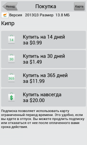
| price of Russian cards | 1350 r. | 1290 (950*) r. | €40 | 1800 r. | for free |
| minimum price | $1** | - | €20 | 990 r. | for free |
| update fee, rub | for free | for free | for free | for free | for free |
| traffic jam service fee, rub | for free | for free | does not work in Russia*** | for free | for free |
| allowed number of resets | 1 | 3 | n.a. | 3 | not limited |
| free third party maps | Yes | Yes | No | Yes | No |
| test period, days | 30 | 30 | 7 | 15 | - |
* if you purchase a key on the developer's website. The price is for the application itself with unlimited access to maps.
** rent of foreign cards.
*** for Europe, the service is paid - from 12 euros per year.
So, the most expensive product is Sygic. It is aimed at the European consumer, so the price tag is quite appropriate. In addition, traffic jams and advanced camera information will have to be paid separately, but this only applies to Europe. In Russia, network services do not work.
The prices of Navitel and Progorod look the most adequate. However, Navitel has a very strict reinstallation policy. Transferring the application to another smartphone, most likely, will not work at all.
Against the backdrop of all these restrictions, Yandex looks like a king. However, the application has a number of significant limitations, thus leaving a good chance for the rest.
Feature set comparison
The developers of most of the presented applications try to attract users with various additional features, for example, weather, photos on the map, articles from encyclopedias, marks in social networks, displaying the location of friends, and even augmented reality.
We have summarized the entire core feature set of all five applications into one table:
| Navitel | Progorod | Sygic | CityGuide | Yandex | |
| Interface | |||||
| Manual map scaling during navigation | Yes | Yes | Yes | Yes | Yes |
| Battery/Satellite/GSM indicators | Yes Yes Yes | yes / yes / no | in the menu / in the menu / no | Yes Yes Yes | OS status bar |
| Change map orientation | Yes | Yes | Yes | Yes | Yes |
| Manual map rotation | Yes | Yes | No | No | Yes |
| Mileage Information | Yes | Yes | Yes | Yes | No |
| Satellite view screen | Yes | Yes | No | No | No |
| 3D Mode | Yes | Yes | Yes | Yes | Yes |
| Map tilt | only in 3D | Yes | Yes | Yes | Yes |
| Quick Access Toolbar | DPOI only | Yes | Yes | Yes | DPOI only |
| "Trip computer" | Yes | No | Yes | Yes | No |
| Night mode | Yes | Yes | Yes | Yes | Yes |
| augmented reality | No | Yes | No | No | No |
| Search | |||||
| Universal | No | No | Yes | No | Yes |
| Address | Yes | Yes | Yes | Yes | No |
| By coordinates | Yes | Yes | Yes | Yes | No |
| POI around / at the point / at the finish line | Yes Yes Yes | Yes Yes Yes | Yes Yes Yes | Yes Yes Yes | Yes Yes Yes |
| Voice input | No | No | No | No | Yes |
| Working with routes | |||||
| Save / Load | Yes | Yes | Yes | Yes | No |
| Route simulation | Yes | Yes | Yes | Yes | No |
| Full display | Yes | Yes | Yes | Yes | Yes |
| Working with tracks | Yes | Yes | No | Yes | No |
| Operating modes: passenger car / truck / pedestrian | Yes Yes Yes | yes / no / no | yes / no / yes | yes / no / yes | yes / no / no |
| Cards | |||||
| Map update | Yes | Yes | Yes | Yes | Yes |
| Provider | n.a. | own | Navteq | many, different | Navteq, Scanex, etc. |
| Installation of third-party and free cards | Yes | yes, based on OSM | No | yes, based on OSM | No |
| Online services | |||||
| Traffic display | Yes | Yes | No * | Yes | Yes |
| Dynamic POIs | Yes | Yes | Yes | Yes | Yes |
| Friends on the map | Yes | No | Yes | Yes | No |
| Thematic news feeds | No | No | No | Yes | No |
| Photo on the map | No | No | yes (panoramio) | No | No |
| Weather | Yes | No | No | No | No |
| Deny access to the network | Yes | by turning off the traffic jam service | No | Yes | No |
* only for European countries for a fee
This table is for self-study. Here everyone must answer the question whether this or that program has a minimum sufficient set of functions. For example, someone definitely needs to work with tracks, and someone needs to install free OSM maps. Some applications also have extraordinary abilities. For example, displaying on the map photos of places taken by Panoramio users (from Sygic), or augmented reality mode (Progorod), as well as speech recognition and voice commands (Yandex.Navigator).
There are applications and major "punctures". So, Sygic does not have a function for displaying traffic (traffic jams), and Yandex.Navigator will not fully work in the absence of an Internet connection.
Interface
Since each of us has our own ideas about beauty, we will not talk much about which interface of which of the programs is more beautiful. Our eye turned out to be nicer to the “picture” of Navitel Navigator, Progorod and Yandex. But this does not mean that the other two programs have some problems with " appearance". They are all good. They just stand out a bit from the general background.
But if we move away from looking at the "pictures", then completely different properties of interfaces come to the fore - practicality and informativeness. The first of these is when you always feel at ease. A cursory glance at the screen is enough for you to get the maximum information you need. Not a very good example of practicality is the interface of the same Navitel - a pile of thin lines and small details makes it difficult to read information while driving. Also practicality includes the convenience of working with the menu and search.
By information content we mean displaying various related information on the screen, such as the speed limit on a given section, information about cameras, etc. The presence of all kinds of tips and additional information in the POI database.
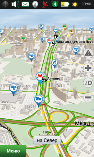
So, below we will give screenshots of the interfaces of all programs with a short list of the main advantages and disadvantages. This time we will use a smartphone with a small screen resolution of 480x800, which is regulated by almost all software developers in today's test.
Let's start with the vertical map view, which is most natural for smartphones and more practical for navigation. Place a 3D version next to the regular map view.
Navitel Navigator 8.5

Progorod 2.0


Sygic 13.4


CityGuide 7.8


Yandex.Navigator 1.5


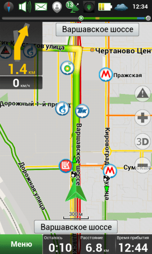
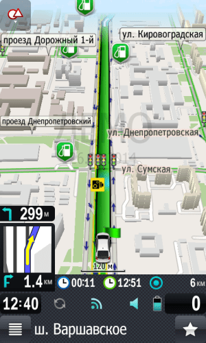
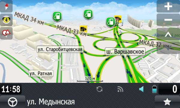
This is the junction of the Varshavskoye highway and the Moscow Ring Road. Alas, the picture is static, and its perception during movement, when the scale of the map is constantly changing depending on the speed and upcoming events (turns), is radically different from what you get just by contemplating these two sets of screenshots. In addition, in 3D mode, a lot depends on the tilt angle, which is adjustable in all programs. The developers made it so that from one angle the map is beautiful and practical, but from another it is already inconvenient to use, because the detail, perspective, etc. change. A similar observation can be made about scales. Therefore, we will give a verbal comment, but first we will post one more portion of screenshots taken in navigation mode:
Navitel Navigator 8.5

Progorod 2.0

Sygic 13.4

CityGuide 7.8

Yandex.Navigator 1.5


Navitel Navigator
The picture deserves all the praise, but it is extremely impractical. The heap of small lines and contours makes it difficult to perceive the route line on the screen, which is slightly thicker than the road itself, but with loaded traffic jams, does not differ in color from it in any way. Camera icons, signs and other details are barely visible on the screen.
Progorod
The “picture” is a bit like Navitel, but there are fewer small details, and the route line is much easier to read than in the previous case. There are two complaints: the status bar takes up a lot of space on the screen and chaos reigns on it, as well as small graphics and all control buttons.
Sygic
In the screenshots, the interface is plain, but in terms of ease of reading information while driving, it deserves the highest rating. A significant minus one is that house numbers are not displayed in navigation mode. They only appear if you try to scroll the map in one of the directions, which will put it in view mode.
CityGuide
The map interface is quite good in practical terms. It may not be as pretty, but it's comfortable enough.
Yandex.Navigator
Trying to find fault with the Yandex.Navigator interface did not work well. He is very practical. The only point is that users of platforms with high pixel density screens complain about small buttons and other menu items. For some reason, these interface elements do not fully comply with Google's recommendations for developers, and programmers operated with absolute units of element sizes instead of relative DP and SP.
Well, for those who for some reason prefer the horizontal position of the map, we will post another set of screenshots.
Navitel Navigator 8.5


Progorod 2.0

Sygic 13.4


CityGuide 7.8


Yandex.Navigator 1.5


Cards
Alas, most developers do not provide detailed information about their cards, because they may not look so brilliant against the background of competitors.
We tried to collect as much information as possible and bring it into one table. Pay attention to the line "Map online" - this is your chance to independently evaluate the quality of coverage. True, it also does not accurately reflect the situation. Navitel and Progorod have not posted the latest release online, while Yandex maps in the application and online are strikingly different in places, which, at times, is bewildering.
| Navitel | Progorod | Sygic | Cityguide | Yandex | |
| Russia: settlements | 149 047 | n.a. | n.a. | n.a. | ≈170 thousand |
| Russia: cities with detail | 8762 | n.a. | n.a. | n.a. | n.a. |
| Road graph, km | 3 809 652 | n.a. | n.a. | n.a. | n.a. |
| POIs | 992 163 | n.a. | n.a.* | n.a. | n.a. |
| Card size, MB | 1250 | 1131 | 623 | 1900 | 1910** (Moscow only) |
| last update date | 25.10.2013 | 22.10.2013 | 12.2013 | 22.01.2014 | n.a. |
| Frequency of updates per year, times | 3-4 | 2 | 1-3 | 2-10*** | n.a. |
| Map online | - | - | |||
| Maps of foreign countries, pcs. | 52 | 28 (OSM) | ≈130 | 10 | 1**** |
| Information about maps on the developer's website | - | - |
* data from Foursquare is also used as POIs
** the volume of the full map of Moscow is indicated
*** The map of Russia is updated almost every month, but the changes in it each time concern a couple or three of some individual regions. If we take, for example, a map of Moscow, then it is updated twice a year.
**** Ukraine, Belarus and Turkey are mentioned. There is no longer a word about Turkey in the branded video, and only Ukraine appears on Google Play. However, in the list of maps for download, you can find, for example, a map of Almaty.
According to the results of the 2010 census, the number of settlements in Russia was slightly more than 153 thousand, and about 20 thousand of them do not have a permanent population. Where did Yandex get 170,000 from then? First, nesting. A particular locality always belongs to other territorial units. Secondly, the census does not take into account all types of settlements. It may fall out railway stations, winter quarters, etc.
So, our leaders, apparently, are Navitel and Yandex. The volume of maps is an indirect indicator. In Yandex.Navigator, it has such unimaginable values because these maps contain a huge number of raster images.
As for the details, this issue is complex, and it takes a lot of time to study it. For our own understanding, we took several settlements and looked at how things are with this issue.
| Navitel | Progorod | Sygic | Cityguide | Yandex | |
| Olenegorsk, Murmansk region | detailed, with houses (3D) | three main streets | only the main street, with errors | detailed, with houses | three main streets |
| Bogoroditsk, Tula region | detailed, with houses | detailed, with houses (3D) | only main street | detailed, with houses | three main streets |
| Angarsk, Irkutsk region | main road network | detailed road network | only main street | detailed, with houses | detailed, with houses |
| Petropavlovsk-Kamchatsky | detailed, with houses | detailed road network | only main street | point on the track | detailed, with houses |
| Astrakhan | detailed, with houses | detailed, with houses (3D) | detailed, with houses | detailed, with houses | detailed, with houses |
| Sochi | detailed, with houses | detailed, with houses (3D) | detailed road network | detailed, with houses | detailed, with houses |
| Chekhov, MO | detailed, with houses | detailed, with houses (3D) | detailed, with houses | detailed, with houses | detailed, with houses |
| Tver | detailed, with houses | detailed, with houses (3D) | detailed, with houses | detailed, with houses | detailed, with houses |
| Rybinsk | detailed, with houses | detailed, with houses (3D) | detailed, with houses | detailed, with houses | detailed, with houses |
| Pechory, Pskov region | detailed, with houses | main road network | three main streets, with errors | detailed, with outlines of houses, without addresses | three main streets |
| village Lanshino, MO | part of the road network | a point on the map | detailed road network | detailed road network | main road network |
The leaders were Navitel, Progorod and Citygid. Moreover, the maps of Progorod in almost all settlements from the table have buildings not only with the corresponding contours, but also with height. Although CityGuide is good (OSM maps are used), you will have to look for maps of the regions you need in a large list and download them separately, which is not very convenient. For some reason, it is impossible to download the entire map of Russia at once. In addition, the Kamchatka Territory was absent from the list.
I was a little surprised by Yandex.Navigator, and this is taking into account the fact that the online browser map is beyond praise. At the same time, it is very funny that in the same Bogoroditsk you can specify the exact address, it will be marked with a marker on the map and the route to it will be built. But "last mile" will be displayed incorrectly.
Well, Sygic dislikes small towns most of all. He knows them only by hearsay.
The relevance of maps is also important. Here we focused on the map of Moscow, noting the presence of new well-known roads, overpasses and interchanges opened during the summer-autumn of 2013. Progorod, Citigid and Yandex had no problems with this. At Navitel, all the interchanges and overpasses we were looking for were present, but for some reason there was no turn under the overpass at the intersection of the Yaroslavl highway and Malyginsky proezd. But Sygic has a map that is at least a year old. We did not find a single desired road object on it.
Our selection of cards: Navitel, Progorod and Cityguide.
Routes and navigation
All applications build quite adequate routes. And this is the most important thing. Small minor "glitches" happen with Navitel. We described one of them in his detailed one, but there is no reason to panic here. But it is definitely worth reducing the sensitivity to traffic jams in its settings for residents of megacities.
To save time for the reader, we will collect information on routes and navigation in one table.
| Navitel | Progorod | Sygic | Cityguide | Yandex | |
| adequacy of the constructed routes | OK | OK | OK | OK | OK |
| number of alternatives | No | 2 | 1 | No | 1-2 |
| exclusion of toll roads / other settings | Yes Yes | Yes Yes | Yes Yes | Yes Yes | no no |
| logic of behavior when leaving the route | customizable | return to the old route | rebuilding in "detour" mode | rebuilding in "detour" mode | |
| traffic jams on the route | Yes | Yes | No | yes, but at a short distance | Yes |
| speed warnings | Yes | Yes | Yes | Yes | No |
| camera alerts | Yes | Yes | Yes | Yes | yes, late |
| DPOI | Yes | Yes | No | Yes | Yes |
| work without internet connection | Yes | Yes | only offline | Yes | features are very limited |
It will be most convenient to travel with Progorod, Cityguide and Navitel. Sygic, despite its very practical interface, works only offline: no traffic jams or DPOI. In addition, its logic of behavior when the driver leaves the route is far from civilized. But there are no less problems with Yandex: it will not warn you about speeding, it will tell you about the camera only when you pass it, and without a connection to the Web, search and route planning will not work in the application! But before starting navigation, he will offer the user alternative route options that can be viewed on the map and choose the most suitable one. Progorod can also do this, although it uses a slightly different logic. We really liked both of these features.
Our choice: Progorod and CityGuide. With some interference - Navitel and Yandex.
Tests
We ran a series of tests to show how fast these apps will run on various mobile platforms. In a separate table, we summarized the results obtained on two systems, the main characteristics of which are as follows:
Both platforms are budget, but the tablet has a 4-core SoC, and the smartphone has a single-core, but with a more modern architecture. Will there be any significant difference between them? In the table, smartphone and tablet data are separated by two vertical bars.
| Navitel | Progorod | Sygic | Cityguide | Yandex | |
| Loading time, s | 11 || 8 | 5-6 on both platforms | 6 || 3 | 12 || 9 | ≈2 in all cases |
| Satellite search time | according to GPS technologies (1-2 min.) | ≈20-30 sec** on both platforms | |||
| Route laying time, s* | 2,5-5 || 1,5-5 | 1-4 on both platforms | 12-20 || 6-15 | ≈2 in all cases | -*** |
| Utilization of computing cores in motion, % | 60 || n.a. | 70 || n.a. | 40 || 15 | 65 || 19 | 20 || n.a. |
| Smooth scrolling and zooming with traffic jams disabled | with strong jerks | with jerks | relatively smoothly | relatively smoothly | smoothly |
| Volume of network traffic on the route, MB/h | 2,5 | n.a. | - | n.a. | n.a. - 4**** |
| Volume of network traffic in the metropolis, MB/h | 4,5 | 1 | - | 1 | 3,5-6,5**** |
* a dash indicates the time of laying two routes: from the south of Moscow to the city of Olenegorsk in the Murmansk region; the second route - to Vladivostok.
** within two seconds after loading you can see your approximate position on the map, determined by the signals base stations and their coordinates. And after another 20-30 seconds, the device "clings" to the satellites.
*** routes are calculated on remote server, and the construction time depends on the quality of communication at a particular time. In the coverage area of GPRS or EDGE, it may take a minute or more, but with a good connection - 2-3 seconds.
**** The first digit indicates the amount of traffic in case of a preloaded full map of the region. The second digit is for an empty map cache.
So, the main problem performance of applications - the inability to use all available computing cores SoC. And although multithreading is declared by almost all developers, in practice, on a 4-core system, this results in the fact that one core is loaded at 100%, the second at 30 percent, and the other two are cool. The only exception is Yandex. The application not only has low system resource requirements, but also active work on four cores, it can show a total load of 60-70%, which indicates that someone still manages to create multi-threaded applications (benchmark developers do not count).
If we talk about the smoothness and comfort of working with the map, then Yandex, Cityguide and Sygic behave quite decently, which cannot be said about Navitel and Progorod. Scrolling the map and scaling them pass with noticeable jerks, slowdowns and jerks. Moreover, if your smartphone has a resolution of 1280 pixels or more, the situation will be aggravated regardless of the type of SoC installed in the system.
Our choice: Yandex, CityGuide and probably Sygic. The latter builds routes for a very long time, but otherwise it is very smart.
Application features
Since the competition is great, the developers are trying to add a few zest to their creation, and it would be a sin not to mention them.
Navitel Navigator
Progorod
Here we note only the augmented reality mode, which will work quite tolerably on those devices where there is an orientation sensor.
Perhaps it will come in handy when traveling by car.
Sygic
Sygic tries to attract users with all sorts of useful and interesting little things: universal search, photos on the map from Panoramio, POIs from Foursquare, articles from Wikipedia (if they have binding to coordinates), a sidebar and a trip computer. All details in the corresponding .
CityGuide
Nothing unusual.
Yandex.Navigator
The main trump card is a universal search with a speech recognition system and voice commands, which works quite well.

Results
So, CityGuide and Progorod got the most mentions marked “our choice”. Navitel, Yandex.Navigator and Sygic are lagging behind. But if we evaluate applications by their main functions (the quality of maps and the navigation process), then we see the following three leaders: Progorod, CityGuide and Navitel. The cheapest of them is Progorod. The most expensive is CityGuide. And Navitel will receive the title of the most unfriendly due to the impossibility of transferring the application to other smartphones.
If you live in one of the Russian cities, in your region there is a reliable and high-quality cellular, you are not afraid of speed cameras and prefer not to spend extra money, then it is quite possible to use Yandex.Navigator. It's free. And besides, it works smartly and has a practical interface.
Sygic can be useful when traveling abroad. However, it will cost quite a bit. In this regard, Navitel is many times more attractive, but it will not contain information about traffic. As well as Sygic in Russia.
P.S. Better to see once than hear a hundred times. Therefore, we encourage you to independently try out the apps you like and draw your own conclusions. But at the same time, it is important not to forget that all navigation programs, without exception, after deleting them through the application manager, leave almost all their files in internal memory phone forever, "freezing" hundreds of useful megabytes. Do not forget to delete them manually later, guided by the names of the folders on the drive. Oh Android, Android...
Having a smartphone or tablet with GPS and GLONASS support, it would be strange not to use it for navigation. And in order for the device to learn how to lay routes for you, it is enough to equip it with a navigator application with maps of the area. There are quite a few applications of this kind, but not all of them are equally useful. We hope this article will help you choose a navigator for Android that will satisfy your needs in the most worthy way. The rating is based on the opinions of experienced drivers and travelers.
Waze
The developer positions Waze as a navigator, which is helped to develop by the Russian driving community. And, I must say, such collective support is good for the application: many drivers are switching to Waze from other navigators that they had been using for years before.
The program allows each participant in the movement to replenish it with information: report accidents, traffic jams, roadworks, traffic police ambushes, prices at gas stations and other things that may be useful to other users.

Features and functionality of Waze
Drivers appreciate Waze for up-to-date information, concise interface, stability in work and, of course, free of charge. A big plus is that the program does not lose routes when Internet access is lost and automatically stops accessing GPS when not used during stops. This reduces the battery's rate of discharge.
The shortcomings of Waze, some users attributed the lack of 3D mode and not always working correctly voice search.
Yandex.Navigator

Another free application that travelers have taken to the top navigators for mobile devices. Contains very detailed and detailed information, useful for both drivers and pedestrians who are in an unfamiliar area on the territory of Russia, Ukraine, Azerbaijan, Georgia, Belarus, Armenia, Kazakhstan, Tajikistan, Moldova and even Turkey (note to tourists).

Features of Yandex.Navigator
- Building up to three route options to a given object, taking into account traffic jams and other traffic events.
- Warning about toll roads and ferries.
- Displays the number of kilometers left to travel to the final destination, as well as the remaining time until arrival.
- Voice guidance trips with alerts about maneuvers, speed limits, traffic events, radars and traffic police crews, etc. Displaying them as symbols on the map.
- Driver warning for speeding.
- Voice control. The option is worked out much better than in Waze. By activating the control of the "Listen, Yandex" command, you can request the construction of a route to the desired point or search for an object on the map.
- Message to the program of information about traffic events, including by voice.
- Storage of the history of trips and routes.
- Search for parking lots (all - only in Moscow within the Third Transport Ring; in other places of the capital and some large cities - St. Petersburg, Kazan, Kiev, Minsk, Nizhny Novgorod, etc., separate large parking lots are displayed).
The best thing that, according to users, Yandex.Navigator has is the coverage of a large territory (especially convenient for those who travel a lot around Russia and neighboring countries) and the ability to control it without hands. Disadvantages - not always up-to-date maps, especially those far from the center of regions and small towns. And also the fact that the program takes up too much space in the device's memory due to the inability to move cards to removable media.

Despite the fact that it is a paid application (the cost of content starts from 560 rubles), it was preferred by more than 20 million users around the world. After all, this is, in fact, the standard by which the developers of other programs for navigation are equal. Among analogues, it has, perhaps, the most big set functions, and there is no such driver who would say that Navitel's capabilities are not enough for him.

A short list of functions and features of Navitel
If you install Navitel from the Google Play store, it will be linked to your account Google, not to the device. Thanks to this, you can use the program on different gadgets.
The strengths of Navitel, according to drivers, are rich functionality, always up-to-date information, a large selection of maps and technical support. The reasons for negative reviews are, as a rule, the limitations of the 7-day trial version, local failures, minor inaccuracies on the maps - the same as with all similar programs.
Maps.me

Maps.me is a free open source Android navigator. source code from Mail.Ru Group. Functions even without access to the Internet, if you download it required cards in advance. Not only for drivers: in addition to roads, Maps.me maps contain walking and cycling tourist routes in many countries around the world.

Key features of Maps.me
- Saving mobile Internet traffic and battery power. Important for cycling and walking, especially where there is no cellular connection (for example, in the forest).
- Itineraries are always up to date and very detailed. The maps include objects that are not available in other applications, since the latter are more focused on the needs of motorists, rather than pedestrians.
- On walking and cycling routes, the degrees of the slope of the terrain are indicated - downhill or uphill.
- Mapping involves users of the program, of which there are more than 65 million worldwide. And you can also join their community.
- In addition to creating routes, Maps.me helps you look for various objects on the ground. Search categories: catering points, hotels and hostels, ATMs, stops public transport, attractions. The search function is available both online and offline.
- Directly from the application, you can book a hotel room (only available online, through the Booking.com website).
- The program allows you to send messages to loved ones indicating your current location. Cellular communication (SMS) can be used for this, social media and web messengers.
The main advantages of Maps.me, according to experienced travelers, are free access to all functions, a large selection of maps (the latter, by the way, are well optimized for mobile devices: with the same amount of content as in other programs, they take up much less space in gadget memory), as well as taking into account the needs of pedestrians and cyclists.
There is, perhaps, only one significant drawback of the application. Since users are involved in mapping, the data often contains errors. In addition, some maps are designed better than others. This again is due to user engagement: where people are more active, the maps are more detailed and accurate. And vice versa.
Google maps, transport and navigation

is another free and ubiquitous navigation app for Android. Used and supported by perhaps the most impressive user community in the world. It helps to navigate in unfamiliar terrain and draw up a route of movement in almost any settlement on the globe.

Features of Google.Maps
- Quickly build routes, taking into account the situation on the road. When obstacles appear - traffic jams, accidents, etc., the route is automatically rebuilt. Automatic selection of the least loaded lane.
- dynamic POIs.
- The ability to quickly obtain information about objects of interest on the ground, for example, catering points. Information about the latter may include user ratings, interior photos, reviews, opening hours, prices, menus, etc.
- Possibility to leave reviews about visited places.
- Always up-to-date data on public transport routes.
- Unique feature: displaying the interior layouts of large public buildings: shopping centers, stations, airports and stadiums, which helps visitors not to get lost in them.
- Description of more than 100 million objects worldwide, as well as more than 220 regions and countries.
Travelers appreciate Google maps primarily for its simplicity, accessibility and convenience. And many called strange experiments of developers, such as integration into the Pac-Man game program, which only distracts the driver while driving and does not carry anything useful, as shortcomings, or rather, excesses.